Search for Lake & Pond Properties
“A lake is the landscape’s most beautiful and expressive feature. It is the earth’s eye, looking into which we measure the depth of our own nature.” – Henry David Thoreau
Maine lakes are one of the major glories of this state so richly endowed by nature. How many Americans have childhood memories of going to camp on a Maine lake?
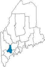
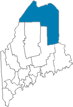
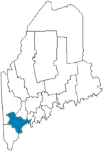
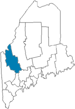
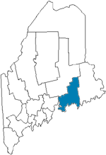
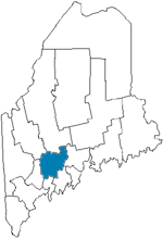
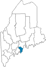
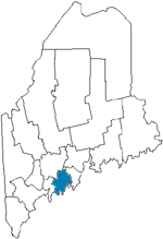
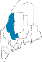
“Land of 1000 Lakes” is a familiar term – a claim made by Minnesota, Ontario Canada, Finland, Poland and even Lithuania, just to name a few. While this claim is not made by Maine, a quick glance at the map will confirm that the landscape is liberally dotted by lakes and ponds. In fact, there are 5,785 of them that are larger than 1 acre, covering 1,762 square miles! Nearly half of these are classified as “Great Ponds”, meaning larger than 10 acres, a term that dates back to Maine’s colonial days.
These lakes not only provide an unmatched recreational resource for fishing, swimming, canoeing and camping but, more importantly, they provide quiet places of raw beauty where people can slow down the pace of their lives and listen to the haunting cry of a loon or watch Canadian geese glide in for a rest stop on their long journey.
Do you want to find your own place on a Maine lake? A good way to start is with a CUSTOMIZED PROPERTY SEARCH. We will email you all the current real estate listings that meet your criteria.
Do you want to find out more information about a specific lake? If you want to know the size, depth, location or fish species, or just about anything else, for a particular lake or pond, just fill in one of the boxes below and then click “Search”.
Find Lake Information:
Search by:
Maine's Lakes & Ponds List
This list of lakes and ponds, by county, includes only those that are 100 acres or more in size.
Androscoggin County
Name |
Size/Acres |
Max Depth/ft. |
Maine Atlas
Map # |
Allen Pond |
183 |
44 |
12 |
Androscoggin Lake |
3826 |
38 |
12 |
Auburn Lake |
2260 |
118 |
11 |
Bear + Little Bear Ponds |
422 |
28 |
11 |
Brettuns Pond |
154 |
42 |
11 |
Little Wilson Pond |
111 |
56 |
11 |
Long Pond |
203 |
18 |
11 |
Lower Range Pond |
290 |
41 |
5 |
Middle Range Pond |
366 |
66 |
5 |
Moose Hill Pond |
99 |
42 |
12 |
No Name Pond |
143 |
32 |
12 |
Pleasant Pond |
177 |
68 |
11 |
Round Pond |
166 |
32 |
11 |
Sabattus Pond |
1787 |
19 |
12 |
Taylor Pond |
625 |
44 |
11 |
Tripp Pond |
768 |
36 |
5 |
Upper Range Pond |
391 |
38 |
5 |
Aroostook County
Name |
Size/Acres |
Max Depth/ft. |
Maine Atlas
Map # |
Arnold Brook Lake |
395 |
12 |
65 |
Beau Lake |
2,003 |
168 |
66 |
Beaver Tail Pond |
128 |
46 |
62 |
Big Machias Lake |
911 |
22 |
63 |
Black Pond |
147 |
90 |
63 |
Blake Lake |
128 |
17 |
67 |
Bracket Lake |
576 |
25 |
45 |
California Pond |
128 |
5 |
68 |
Caribou Lake |
115 |
3 |
65 |
Carr Pond |
307 |
72 |
63 |
Center Pond |
128 |
4 |
57 |
Chandler Pond |
401 |
19 |
57 |
Clayton Lake |
166 |
7 |
61 |
Clayton Lake |
264 |
17 |
63 |
Cross Lake |
2,515 |
46 |
68 |
Crystal Lake |
137 |
11 |
52 |
Cunliffe Lake |
134 |
20 |
61 |
Deboullie Pond |
262 |
88 |
63 |
Deering Lake |
474 |
49 |
53 |
Depot Lake |
883 |
10 |
60 |
Dickwood Lake |
96 |
8 |
67 |
Eagle Lake |
5,581 |
136 |
67,68 |
East Grand Lake |
16,070 |
128 |
53,45 |
Echo Lake |
90 |
9 |
65 |
Falls Pond |
256 |
7 |
66 |
First Musquacook Lake |
698 |
48 |
62 |
First Sly Brook Lake |
90 |
32 |
67 |
1st/2nd Wallagrass Lakes |
281 |
33 |
67 |
Fish River Lake |
2,642 |
46 |
63 |
Flinn Lake |
269 |
17 |
44,52 |
4th Musquacook Lake |
749 |
40 |
56 |
Gardner Pond |
288 |
120 |
63 |
Germain Lake |
122 |
3 |
68 |
Glazier Lake |
1,120 |
118 |
66 |
Greenlaw Pond |
109 |
6 |
63 |
Hanson Lake |
118 |
32 |
65 |
Little East Lake |
189 |
5 |
70 |
Little Machias Lake |
275 |
18 |
63 |
Long Lake |
6,000 |
163 |
68 |
Long Lake/ Harvey Pond |
1,203 |
48 |
61 |
Long Pond |
128 |
9 |
62 |
Madawaska Lake |
1,526 |
38 |
68 |
Mattaseunk Lake |
576 |
21 |
44 |
Mattawamkeag Lake |
3,330 |
47 |
52 |
McGowan Lake |
160 |
5 |
63 |
McKeen Lake |
147 |
10 |
62 |
Meduxnekeag Lake |
1,057 |
49 |
53 |
Molunkus Lake |
1,050 |
38 |
44 |
Monson Pond |
160 |
15 |
65 |
Mud Lake |
972 |
20 |
68 |
Nickerson Lake |
234 |
107 |
53 |
Number Nine Lake |
120 |
10 |
59 |
Pickett Mountain Pond |
173 |
7 |
52 |
Pleasant Lake |
1,832 |
63 |
52 |
Plunkett Pond |
435 |
42 |
52 |
Portage Lake |
2,474 |
25 |
63,64 |
Pratt Lake |
96 |
11 |
63 |
Presley Lake |
202 |
5 |
60 |
Rockabema Lake |
339 |
40 |
58 |
Round Pond |
697 |
36 |
62 |
Rowe Lake |
252 |
40 |
63 |
St Croix Lake |
416 |
9 |
58 |
St. Froid Lake |
2,400 |
114 |
63 |
Second Chase Pond |
182 |
123 |
62,63 |
2nd Musquacook Lake |
813 |
62 |
62 |
Skitacook Lake |
435 |
17 |
53 |
Soldier Pond |
96 |
49 |
67 |
Spaulding Lake |
125 |
38 |
52 |
Spectacle Pond |
122 |
5 |
57 |
Squapan Lake |
5,120 |
58 |
58,64 |
Square Lake |
8,150 |
122 |
68 |
Third Chase Pond |
102 |
87 |
62 |
3rd Musquacook Lake |
397 |
64 |
62 |
3rd Sly Brook Lake |
141 |
51 |
67 |
Togue Pond |
388 |
85 |
63 |
Umcolcus Lake |
630 |
17 |
58 |
Umsaskis Lake |
1,222 |
58 |
61 |
Upper Macwahoc Lake |
269 |
8 |
52 |
Wheelock Lake |
160 |
20 |
67 |
Wytopitlock Lake |
1,152 |
24 |
52 |
Cumberland County
Name |
Size/Acres |
Max Depth/ft. |
Maine Atlas
Map # |
Bonny Eagle Lake |
211 |
22 |
4 |
Brandy Pond |
762 |
44 |
4,5 |
Coffee Pond |
137 |
70 |
5 |
Crescent Lake |
716 |
54 |
5 |
Crystal Lake |
461 |
65 |
10 |
Crystal Lake |
189 |
59 |
5 |
Dundee Pond |
173 |
42 |
5 |
Forest Lake |
198 |
38 |
5 |
Great Pond |
131 |
5 |
3 |
Hancock Pond |
858 |
59 |
4 |
Highland Lake |
1401 |
40 |
4,10 |
Highland Lake |
640 |
67 |
5 |
Ingalls Pond |
141 |
28 |
4 |
Island Pond |
166 |
48 |
10 |
Little Sebago Lake |
1898 |
52 |
5 |
Moose Pond |
1694 |
70 |
4 |
North Gorham Pond |
128 |
23 |
5 |
Otter Pond |
90 |
21 |
4 |
Panther Pond |
1430 |
65 |
5 |
Parker Pond |
166 |
19 |
5 |
Peabody Pond |
735 |
64 |
4 |
Pleasant Lake |
1077 |
62 |
5 |
Raymond Pond |
346 |
42 |
5 |
Sabbathday Lake |
340 |
68 |
5 |
Sebago Lake |
28,771 |
316 |
4 |
Southeast Pond |
173 |
30 |
4 |
Thomas Pond |
442 |
64 |
5 |
Trickey Pond |
311 |
57 |
4 |
Watchic Pond |
448 |
41 |
4 |
Wood Pond |
456 |
29 |
4 |
Franklin County
Name |
Size/Acres |
Max Depth/ft. |
Maine Atlas
Map # |
Arnold Pond |
148 |
62 |
38 |
Beaver Mountain Lake |
543 |
52 |
18 |
Big Island Pond |
350 |
40 |
28 |
Chain of Ponds |
700 |
106 |
38,28 |
Clearwater Pond |
751 |
129 |
20 |
Crowell Pond |
211 |
10 |
20 |
Dodge Pond |
230 |
51 |
28 |
Flagstaff Lake |
20,300 |
48 |
29 |
Gull Pond |
281 |
40 |
28 |
Haley Pond |
170 |
23 |
28 |
Jim Pond |
320 |
125 |
29 |
Johns Pond |
267 |
49 |
28 |
Kennebago Lake |
1,700 |
116 |
28 |
Little Kennebago Lake |
190 |
56 |
28 |
Long Pond |
254 |
114 |
18 |
Loon Lake |
192 |
50 |
28 |
L Pond |
100 |
14 |
28 |
Mooselookmeguntic/
Cupsuptic |
16,300 |
123 |
18 |
Mount Blue Pond |
134 |
38 |
19 |
Norcross Pond |
122 |
24 |
20 |
North Pond |
170 |
23 |
20 |
Parker Pond |
128 |
26 |
20 |
Pease Pond |
107 |
19 |
19 |
Porter Lake |
527 |
88 |
20 |
Quimby Pond |
165 |
12 |
28 |
Rangeley Lake |
6,000 |
149 |
28 |
Redington Pond |
90 |
17 |
29 |
Round Pond |
166 |
50 |
28 |
Saddleback Lake |
358 |
14 |
29 |
Sand Pond |
103 |
23 |
20 |
Tea Pond |
90 |
115 |
29 |
Tim Pond |
314 |
46 |
28 |
Varnum Pond |
370 |
75 |
19 |
Webb Lake |
2,146 |
42 |
19 |
Wilson Pond |
480 |
88 |
19 |
Hancock County
Name |
Size/Acres |
Max Depth/ft. |
Maine Atlas
Map # |
Arnold Brook Lake |
395 |
12 |
65 |
Beau Lake |
2,003 |
168 |
66 |
Beaver Tail Pond |
128 |
46 |
62 |
Big Machias Lake |
911 |
22 |
63 |
Black Pond |
147 |
90 |
63 |
Blake Lake |
128 |
17 |
67 |
Bracket Lake |
576 |
25 |
45 |
California Pond |
128 |
5 |
68 |
Caribou Lake |
115 |
3 |
65 |
Carr Pond |
307 |
72 |
63 |
Center Pond |
128 |
4 |
57 |
Chandler Pond |
401 |
19 |
57 |
Clayton Lake |
166 |
7 |
61 |
Clayton Lake |
264 |
17 |
63 |
Cross Lake |
2,515 |
46 |
68 |
Crystal Lake |
137 |
11 |
52 |
Cunliffe Lake |
134 |
20 |
61 |
Deboullie Pond |
262 |
88 |
63 |
Deering Lake |
474 |
49 |
53 |
Depot Lake |
883 |
10 |
60 |
Dickwood Lake |
96 |
8 |
67 |
Eagle Lake |
5,581 |
136 |
67,68 |
East Grand Lake |
16,070 |
128 |
53,45 |
Echo Lake |
90 |
9 |
65 |
Falls Pond |
256 |
7 |
66 |
First Musquacook Lake |
698 |
48 |
62 |
First Sly Brook Lake |
90 |
32 |
67 |
1st/2nd Wallagrass Lakes |
281 |
33 |
67 |
Fish River Lake |
2,642 |
46 |
63 |
Flinn Lake |
269 |
17 |
44,52 |
4th Musquacook Lake |
749 |
40 |
56 |
Gardner Pond |
288 |
120 |
63 |
Germain Lake |
122 |
3 |
68 |
Glazier Lake |
1,120 |
118 |
66 |
Greenlaw Pond |
109 |
6 |
63 |
Hanson Lake |
118 |
32 |
65 |
Little East Lake |
189 |
5 |
70 |
Little Machias Lake |
275 |
18 |
63 |
Long Lake |
6,000 |
163 |
68 |
Long Lake/ Harvey Pond |
1,203 |
48 |
61 |
Long Pond |
128 |
9 |
62 |
Madawaska Lake |
1,526 |
38 |
68 |
Mattaseunk Lake |
576 |
21 |
44 |
Mattawamkeag Lake |
3,330 |
47 |
52 |
McGowan Lake |
160 |
5 |
63 |
McKeen Lake |
147 |
10 |
62 |
Meduxnekeag Lake |
1,057 |
49 |
53 |
Molunkus Lake |
1,050 |
38 |
44 |
Monson Pond |
160 |
15 |
65 |
Mud Lake |
972 |
20 |
68 |
Nickerson Lake |
234 |
107 |
53 |
Number Nine Lake |
120 |
10 |
59 |
Pickett Mountain Pond |
173 |
7 |
52 |
Pleasant Lake |
1,832 |
63 |
52 |
Plunkett Pond |
435 |
42 |
52 |
Portage Lake |
2,474 |
25 |
63,64 |
Pratt Lake |
96 |
11 |
63 |
Presley Lake |
202 |
5 |
60 |
Rockabema Lake |
339 |
40 |
58 |
Round Pond |
697 |
36 |
62 |
Rowe Lake |
252 |
40 |
63 |
St Croix Lake |
416 |
9 |
58 |
St. Froid Lake |
2,400 |
114 |
63 |
Second Chase Pond |
182 |
123 |
62,63 |
2nd Musquacook Lake |
813 |
62 |
62 |
Skitacook Lake |
435 |
17 |
53 |
Soldier Pond |
96 |
49 |
67 |
Spaulding Lake |
125 |
38 |
52 |
Spectacle Pond |
122 |
5 |
57 |
Squapan Lake |
5,120 |
58 |
58,64 |
Square Lake |
8,150 |
122 |
68 |
Third Chase Pond |
102 |
87 |
62 |
3rd Musquacook Lake |
397 |
64 |
62 |
3rd Sly Brook Lake |
141 |
51 |
67 |
Togue Pond |
388 |
85 |
63 |
Umcolcus Lake |
630 |
17 |
58 |
Umsaskis Lake |
1,222 |
58 |
61 |
Upper Macwahoc Lake |
269 |
8 |
52 |
Wheelock Lake |
160 |
20 |
67 |
Wytopitlock Lake |
1,152 |
24 |
52 |
Kennebec County
Name |
Size/Acres |
Max Depth/ft. |
Maine Atlas
Map # |
Androscoggin Lake |
3,826 |
38 |
12 |
Annabessacook Lake |
1,420 |
49 |
12 |
Berry and Dexter Ponds |
290 |
25 |
12 |
Branch Pond |
322 |
38 |
13 |
China Lake |
3,922 |
85 |
13 |
Cobbosseecontee Lake |
5,543 |
100 |
12 |
Cochnewagan Pond |
385 |
28 |
12 |
David Pond |
284 |
37 |
12 |
East Pond |
1,823 |
27 |
20 |
Echo Lake |
1,061 |
117 |
12 |
Flying Pond |
360 |
80 |
20 |
Great Pond |
8,239 |
69 |
20,12 |
Hutchinson Pond |
100 |
24 |
12 |
Jamies Pond |
107 |
75 |
12 |
Little Togus Pond |
93 |
22 |
13 |
Long Pond |
2,714 |
106 |
12,20 |
Long Pond |
747 |
16 |
13 |
Lovejoy Pond |
324 |
32 |
21 |
Lovejoy Pond |
366 |
22 |
12 |
Lower Narrows Pond |
255 |
106 |
12 |
Maranacook Lake |
1,673 |
128 |
12 |
Messalonskee Lake |
3,510 |
113 |
12,20,21 |
Minnehonk Lake |
99 |
73 |
12 |
Mud Pond |
112 |
12 |
13 |
Nehumkeag Pond |
173 |
15 |
13 |
North and Little Ponds |
2,115 |
20 |
20 |
Parker Pond |
1,610 |
76 |
12,20 |
Pattee Pond |
712 |
27 |
21 |
Pleasant Pond |
746 |
26 |
12 |
Pocasset Lake |
587 |
20 |
12 |
Salmon Lake/
McGrath Pond |
1,048 |
57 |
20 |
Sand / Woodbury Ponds |
613 |
82 |
12 |
Spectacle Pond |
139 |
100 |
13 |
Threecornered Pond |
195 |
33 |
13 |
Threemile Pond |
1,077 |
37 |
13 |
Tilton Pond |
114 |
44 |
12 |
Togus Pond |
648 |
49 |
13 |
Torsey Pond |
770 |
45 |
12 |
Upper Narrows Pond |
279 |
54 |
12 |
Webber Pond |
1,252 |
41 |
13 |
Wilson Pond |
574 |
42 |
12 |
Knox County
Name |
Size/Acres |
Max Depth/ft. |
Maine Atlas
Map # |
Alford Lake |
542 |
78 |
14 |
Chickawaukie Pond |
343 |
33 |
14 |
Crawford Pond |
585 |
57 |
14 |
Grassy Pond |
136 |
12 |
14 |
Hobbs Pond |
131 |
20 |
14 |
Lermond Pond |
156 |
30 |
14 |
Megunticook Pond |
1,220 |
64 |
14 |
North Pond |
326 |
41 |
14 |
Round Pond |
257 |
37 |
14 |
Sennebec Pond |
511 |
57 |
14 |
Seven Tree Pond |
490 |
45 |
14 |
South Pond |
517 |
18 |
14 |
Washington Pond |
581 |
36 |
13 |
Lincoln County
Name |
Size/Acres |
Max Depth/ft. |
Maine Atlas
Map # |
Biscay Pond |
377 |
61 |
7 |
Damariscotta Lake |
4,625 |
114 |
13 |
Duckpuddle Pond |
293 |
23 |
13 |
Dyer Long Pond |
392 |
16 |
13 |
Little Dyer Pond |
109 |
19 |
13 |
Long Pond |
747 |
16 |
13 |
McCurdy Pond |
207 |
41 |
7 |
Medomak Pond |
228 |
25 |
13 |
Muddy Pond |
156 |
11 |
7 |
Pemaquid Pond |
1,515 |
61 |
7 |
Pleasant Pond |
682 |
22 |
13 |
Sherman Lake |
237 |
16 |
7 |
Sidensparker Pond |
160 |
14 |
14 |
Travel Pond |
102 |
6 |
13 |
Turner Pond |
145 |
7 |
13 |
Webber Pond |
253 |
31 |
7 |
Oxford County
Name |
Size/Acres |
Max Depth/ft. |
Maine Atlas
Map # |
Anasagunticook Lake |
568 |
54 |
11 |
Aziscohus Lake |
6,700 |
60 |
28 |
B Pond |
471 |
110 |
18 |
Bear Pond |
218 |
72 |
10 |
Beaver Pond |
128 |
8 |
4 |
Beaver Pond |
179 |
72 |
18 |
Bickford Pond |
237 |
69 |
4 |
Big Concord Pond |
135 |
12 |
11 |
Bryant Pond |
278 |
63 |
10 |
C Pond |
173 |
36 |
18 |
Colcord Pond |
304 |
105 |
4 |
Ellis Pond |
896 |
43 |
18 |
Granger Pond |
125 |
28 |
4 |
Hogan Pond |
177 |
34 |
11 |
Horseshoe Pond |
132 |
40 |
10 |
Howard Pond |
109 |
118 |
18 |
Keewaydin Lake |
307 |
52 |
10 |
Kecka Lake |
467 |
42 |
10 |
Keys Pond |
192 |
42 |
10 |
Kezar Lake |
2,510 |
155 |
10 |
Kezar Pond |
1,447 |
12 |
4,10 |
Labrador Pond |
115 |
13 |
11 |
Lincoln Pond |
340 |
95 |
28 |
Little Ellis Pond |
297 |
41 |
18 |
Little Moose Pond |
181 |
43 |
10 |
Long Pond |
473 |
42 |
10 |
Lovewell Pond |
1,065 |
45 |
4 |
Lower Kimball Pond |
486 |
65 |
10 |
Marshall Pond |
102 |
41 |
11 |
Mooselookmeguntic Lake |
16,300 |
132 |
18,28 |
Moose Pond |
160 |
16 |
11 |
North Pond |
147 |
10 |
10,11 |
North Pond |
128 |
50 |
11 |
North Pond |
284 |
50 |
11 |
Parmachenee Lake |
912 |
93 |
28 |
Pennesseewassee Lake |
922 |
48 |
10,11 |
Pleasant Pond |
239 |
15 |
4 |
Pleasant Pond |
115 |
14 |
11 |
Pond in the River |
512 |
40 |
18 |
Richardson Lake |
7,100 |
100 |
18 |
Sand Pond |
141 |
56 |
10 |
Saturday Pond |
178 |
25 |
11 |
Songo Pond |
224 |
25 |
10 |
South & Rounds Pond |
284 |
71 |
10 |
Stanely Pond |
137 |
75 |
4 |
Sterns Pond |
255 |
47 |
10 |
Sturtenant Pond |
518 |
58 |
17 |
Thompson Lake |
4,426 |
121 |
5,11 |
Twitchell Pond |
158 |
47 |
10 |
Umbagog Lake |
7,850 |
48 |
17 |
Virginia Lake |
128 |
26 |
10 |
Walden Pond |
256 |
44 |
4 |
West Richardson Pond |
423 |
41 |
28 |
Whitney Pond |
170 |
24 |
11 |
Worthley Pond |
354 |
49 |
11 |
Penobscot County
Name |
Size/Acres |
Max Depth/ft. |
Maine Atlas
Map # |
Bottle Lake |
281 |
42 |
35 |
Bowlin Pond |
115 |
12 |
51 |
Brewer Pond |
881 |
48 |
23 |
Cambolasse Pond |
211 |
32 |
44 |
Caribou / Long / Egg Ponds |
825 |
46 |
44 |
Cedar Lake |
685 |
25 |
43 |
Center Pond |
192 |
12 |
44 |
Chemo Pond |
1,146 |
24 |
23 |
Cold Stream Pond |
3,628 |
104 |
33 |
Cut Lake |
294 |
9 |
57 |
Davis Pond |
417 |
14 |
23 |
Duck Lake |
256 |
24 |
45 |
Endless Lake |
1,499 |
36 |
43 |
Eskutassis Lake |
876 |
40 |
34 |
Etna Pond |
361 |
12 |
22 |
Fields Pond |
182 |
31 |
23 |
Fitts Pond |
106 |
64 |
23 |
Flatiron Pond |
284 |
18 |
43 |
Folsom Pond |
282 |
18 |
43 |
Garland Pond |
102 |
14 |
32 |
Green Pond |
110 |
16 |
34 |
Hay Lake |
134 |
24 |
51,57 |
Hermon Pond |
461 |
17 |
22 |
Holbrook Pond |
280 |
28 |
23 |
Hopkins Pond |
442 |
65 |
24 |
Horseshoe Lake |
400 |
25 |
35 |
Jerry Pond |
272 |
13 |
51 |
Junior Lake |
3,866 |
70 |
35 |
Katahdin Lake |
717 |
28 |
51 |
Keg Lake |
378 |
40 |
35 |
Little Mattamiscontis Lake |
275 |
12 |
43 |
Little Pushaw Pond |
411 |
18 |
32 |
Little Salmon Stream Lake |
218 |
7 |
52 |
Lombard Lake |
225 |
38 |
44 |
Lowell Lake |
115 |
6 |
44 |
Lower Shin Pond |
560 |
25 |
51 |
Lunksoss Lake |
288 |
15 |
51 |
Madagascal Ponds |
790 |
35 |
34 |
Matagamon Lake |
4,165 |
95 |
51,57 |
Mattakeunk Lake |
570 |
29 |
44 |
Mattamiscontis Lake |
1,025 |
36 |
43 |
Mattanawcook Pond |
832 |
22 |
44 |
Middle Jo-Mary / Turkeytail Lakes |
1,152 |
24 |
42 |
Millimagassett Lake |
1,410 |
62 |
57 |
Millinocket Lake |
8,960 |
86 |
43,51 |
Mill Privilege Lake |
109 |
28 |
45 |
Mud Pond |
385 |
12 |
33 |
Nollesemic Lake |
660 |
22 |
43 |
Number Three Pond |
659 |
34 |
34 |
Parks Pond |
124 |
28 |
23,24 |
Pemadumcook Lakes |
18,300 |
101 |
42,43 |
Pickett Mountain Pond |
173 |
7 |
52 |
Pleasant / Mud Lakes |
325 |
16 |
52 |
Pleasant Lake |
768 |
16 |
22 |
Plymoth Pond |
480 |
10 |
22 |
Puffers Pond |
102 |
52 |
32 |
Pushaw Lake |
5,056 |
28 |
23,33 |
Round Pond |
134 |
30 |
22 |
Rush Pond |
243 |
12 |
52 |
Salmon Stream Lake |
659 |
15 |
44 |
Saponac Pond |
922 |
16 |
34 |
Sawtelle Deadwater |
218 |
30 |
51,57 |
Scraggely Lake |
2,758 |
42 |
35,45 |
Scraggly Lake |
842 |
70 |
57 |
Sebasticook Lake |
4,288 |
50 |
22 |
Seboeis Grand Lake |
2,483 |
33 |
57 |
Shaw Lake |
211 |
30 |
45 |
Smith Pond |
206 |
14 |
43 |
Snag Pond |
160 |
13 |
44 |
Snowshoe Lake |
638 |
44 |
57 |
South Branch Lake |
2,035 |
28 |
43 |
Sweets Pond |
125 |
24 |
23 |
Sysladobsis Lake |
5,376 |
66 |
35 |
Umcolcus Lake |
630 |
17 |
58 |
Upper Cold Stream Pond |
685 |
66 |
34 |
Upper LaPomkeag Lake |
217 |
6 |
57 |
Upper Pond |
506 |
31 |
34,44 |
Upper Shin Pond |
544 |
64 |
51 |
Upper Sysladobsis Lake |
1,142 |
42 |
34 |
Wassookeag Lake |
1,062 |
86 |
32 |
White Horse Lake |
218 |
11 |
57 |
Piscataquis County
Name |
Size/Acres |
Max Depth/ft. |
Maine Atlas
Map # |
Allagash Lake |
4,260 |
89 |
55 |
B Pond |
644 |
34 |
42 |
Big Beaver Pond |
329 |
24 |
57 |
Big Benson Pond |
320 |
83 |
42 |
Big Greenwood Pond |
211 |
109 |
41 |
Big Hurd Pond |
250 |
24 |
49 |
Big Indian Pond |
280 |
68 |
41 |
Big Lyford Pond |
152 |
40 |
42 |
Big Pleasant Lake |
979 |
35 |
56 |
Big Pine Pond |
164 |
33 |
49 |
Big Pleasant Pond |
195 |
52 |
42 |
Boyd Lake |
1,005 |
20 |
32,33 |
Branns Mill Pond |
271 |
15 |
32 |
Brown Pond |
104 |
6 |
57 |
Burden Pond |
197 |
32 |
42 |
Burnham Pond |
426 |
9 |
41 |
Carpenter Pond |
160 |
50 |
56 |
Caucomogomoc Lake |
5,081 |
79 |
55 |
Center Pond |
403 |
19 |
32 |
Chamberlain Lake |
11,084 |
154 |
55,56 |
Chandler Pond |
115 |
30 |
56 |
Chase Lake |
403 |
31 |
56 |
Chemquasabamticook Lake |
2,892 |
105 |
55 |
Chesuncook Lake |
28,200 |
150 |
49,50 |
Chesuncook Pond |
272 |
30 |
50 |
Churchill / Heron Lakes |
2,923 |
62 |
55,56 |
Clear Lake |
614 |
86 |
56 |
Cliff/Twin Lakes |
563 |
65 |
56 |
Coffelos Pond |
196 |
24 |
50 |
Cooper Pond |
271 |
15 |
42 |
Crawford Pond |
390 |
62 |
42 |
Crescent Pond |
320 |
68 |
55 |
Cuxaexis Lake |
592 |
10 |
50 |
Daggett Pond |
461 |
20 |
55 |
Deer Pond |
181 |
36 |
49 |
Ebeemee Lake |
940 |
47 |
42 |
Eagle Lake |
5,317 |
124 |
55,56 |
Echo Lake |
115 |
45 |
56 |
Female Pond |
102 |
65 |
42 |
Fifth Mesquacook Lake |
358 |
5 |
56 |
First Buttermilk Pond |
384 |
119 |
32 |
First Davis Pond |
128 |
54 |
31 |
First Debsconeag Lake |
227 |
150 |
42,50 |
Fourth Musquacook Lake |
749 |
40 |
56 |
Frost Pond |
198 |
39 |
50 |
Hale Pond |
168 |
58 |
50 |
Harrington Pond |
1,332 |
134 |
50 |
Harrow Lake |
467 |
30 |
56 |
Haymock Lake |
704 |
61 |
56 |
Hebron Lake |
525 |
102 |
31 |
Henderson Pond |
195 |
91 |
42 |
Holbrook Pond |
224 |
80 |
50 |
Horseshoe Pond |
160 |
35 |
41 |
Houston Pond |
694 |
92 |
42 |
Hudson Pond |
128 |
10 |
56 |
Hurd Pond |
640 |
92 |
50 |
Indian Pond |
1,222 |
52 |
56 |
Indian Pond |
299 |
52 |
42 |
Island Pond |
214 |
32 |
56 |
Johnson Pond |
197 |
58 |
55 |
Kingsbury / Mayfield Ponds |
531 |
62 |
31 |
Little Beaver Pond |
122 |
25 |
57 |
Little Benson Pond |
152 |
33 |
42 |
Little Lobster Lake |
230 |
36 |
49 |
Little Sourdnahunk Lake |
102 |
15 |
50 |
Lobster Lake |
230 |
36 |
49 |
Long Pond |
371 |
50 |
42 |
Long Pond |
643 |
64 |
41 |
Longely Pond |
749 |
10 |
49 |
Loon Lake |
1,140 |
45 |
49 |
Lower Hudson Pond |
108 |
50 |
56 |
Lower Jo-Mary Lake |
1,912 |
64 |
42 |
Lower Wilson Pond |
1,380 |
106 |
41 |
Lower Togue Pond |
364 |
53 |
51 |
Manhanock / Harlow Ponds |
595 |
36 |
31 |
Millinocket Lake |
8,960 |
86 |
43,51 |
Millinocket Lake |
2,701 |
50 |
57 |
Monson Pond |
359 |
92 |
31 |
Moosehead Lake |
74,890 |
246 |
40,41,48,49 |
Mooseleuk Lake |
422 |
6 |
57 |
Mud Pond |
1,357 |
12 |
56 |
Munsungan Lake |
1,415 |
123 |
56 |
Nahmakanta Lake |
1,024 |
110 |
42,50 |
Narrow Pond |
151 |
6 |
55 |
Onawa Lake |
1,344 |
76 |
41 |
Otter Pond |
109 |
9 |
55 |
Passamagamet Lake |
461 |
34 |
42,50 |
Penobscot Pond |
279 |
20 |
42 |
Pemadumcook Chain |
18,300 |
101 |
42,43 |
Pillsbury Pond |
301 |
2 |
56 |
Piper Pond |
420 |
56 |
31 |
Poland Pond |
490 |
34 |
55 |
Pollywog Pond |
147 |
58 |
50 |
Priestly Lake |
645 |
50 |
55 |
Prong Pond |
427 |
27 |
41 |
Ragged Lake |
2,712 |
54 |
49 |
Rainbow Lake |
1,664 |
130 |
50 |
First Roach Pond |
3,270 |
123 |
41 |
Second Roach Pond |
970 |
46 |
42 |
Third Roach Pond |
570 |
28 |
42 |
Fourth Roach Pond |
266 |
38 |
42 |
Rocky Pond |
115 |
6 |
42 |
Round Pond |
375 |
17 |
55 |
Rum Pond |
245 |
77 |
41 |
Schoodic Lake |
7,168 |
188 |
32,42 |
Sebec Lake |
6,803 |
155 |
31,32 |
Seboeis Lake |
4,201 |
69 |
43 |
Second Debsconeag Lake |
189 |
28 |
50 |
2nd/3rd West Branch Ponds |
214 |
20 |
42 |
Silver Lake |
305 |
28 |
42 |
Snake Pond |
275 |
42 |
56 |
Soper Pond |
246 |
11 |
56 |
Sourdnahunk Lake |
1,394 |
46 |
50 |
Spectacle Pond |
177 |
38 |
41 |
Spencer Pond |
980 |
16 |
41,49 |
Spider Lake |
890 |
59 |
56 |
Telos/Round Ponds |
2,276 |
86 |
50,56 |
Third Debsconeag Lake |
1,011 |
162 |
42,50 |
Third Lake |
474 |
37 |
56 |
Thissell Pond |
141 |
42 |
50 |
Trout Pond |
145 |
20 |
42 |
Umbazooksus Lake |
1,590 |
15 |
49,55 |
Upper Ebeemee Lake |
196 |
20 |
42 |
Upper Jo-Mary Lake |
1,873 |
72 |
42 |
Upper Russell Pond |
282 |
16 |
55 |
Upper Togue Pond |
294 |
34 |
51 |
Upper Wilson Pond |
940 |
64 |
41 |
Wadleigh Pond |
225 |
83 |
42 |
Wadleigh Pond |
157 |
46 |
55 |
Wassataquoik Lake |
178 |
79 |
50 |
Webster Lake |
531 |
44 |
50 |
Sagadahoc County
Name |
Size/Acres |
Max Depth/ft. |
Maine Atlas
Map # |
Nequasset Lake |
392 |
63 |
6 |
Pleasant Pond |
746 |
26 |
12 |
Winnegance Creek |
137 |
22 |
6 |
Somerset County
Name |
Size/Acres |
Max Depth/ft. |
Maine Atlas
Map # |
Attean Pond |
2,745 |
55 |
39 |
Austin Pond |
684 |
34 |
30,31 |
Baker Lake |
1,231 |
30 |
54 |
Baker Pond |
186 |
74 |
30 |
Bald Mountain Pond |
1,152 |
62 |
31 |
Barker Pond |
106 |
42 |
21 |
Big Grenier Pond |
110 |
15 |
47 |
Big Indian Pond |
990 |
28 |
31 |
Black Brook Pond |
333 |
22 |
40 |
Brassva Lake |
8,979 |
65 |
40 |
Canada Falls Lake |
2,627 |
24 |
48 |
Cheney Pond |
100 |
35 |
47 |
Cold Stream Pond |
205 |
62 |
40 |
Crocker Pond |
227 |
30 |
39 |
Demo Pond |
192 |
12 |
40 |
Dole Pond |
704 |
50 |
47 |
Duncan Pond |
143 |
52 |
47 |
East Carry Pond |
267 |
30 |
30 |
East Pond |
1,823 |
27 |
20 |
Embden Pond |
1,568 |
158 |
20.30 |
Enchanted Pond |
330 |
185 |
39 |
Fahi Pond |
196 |
11 |
20 |
Fifth St. John Pond |
1,208 |
20 |
48 |
Fish Pond |
211 |
58 |
40 |
Flagstaff Lake |
20,300 |
50 |
29 |
Foley Pond |
124 |
42 |
48 |
Fourth St. John Pond |
196 |
22 |
48 |
Frost Pond |
170 |
10 |
47 |
Grace Pond |
150 |
41 |
39 |
Hancock Pond |
320 |
106 |
30 |
Heald Pond |
186 |
42 |
39 |
Holeb Pond |
1,055 |
52 |
39 |
Indian Pond |
3,746 |
118 |
40 |
Jones Pond |
130 |
20 |
47 |
King/Bartlett Lake |
538 |
159 |
39 |
Kingsbury/Mayfield Ponds |
531 |
62 |
31 |
Knights Pond |
128 |
31 |
40 |
Lake George |
335 |
68 |
21 |
Little Austin Pond |
110 |
33 |
30 |
Little Big Wood Pond |
713 |
80 |
39 |
Little Indian Pond |
145 |
13 |
31 |
Long Pond |
845 |
50 |
48 |
Long Pond |
3,053 |
44 |
40 |
Long Pond |
173 |
29 |
40 |
Luther Pond |
154 |
9 |
40 |
Middle Carry Pond |
126 |
42 |
30 |
Moose Pond |
3,584 |
50 |
21,31 |
Morrill Pond |
134 |
48 |
21 |
Moxie Pond |
2,370 |
51 |
30,40 |
Nokomis Pond |
199 |
24 |
22 |
North/Little Ponds |
2,115 |
20 |
20 |
Oaks Pond |
102 |
53 |
21 |
Parlin Pond |
543 |
32 |
40 |
Penobscot Lake |
1,019 |
104 |
47 |
Pierce Pond |
1,650 |
120 |
30 |
Ripley Pond |
220 |
12 |
31 |
Rock Pond |
124 |
30 |
39 |
Rowe Pond |
205 |
43 |
30 |
Russell Pond |
152 |
19 |
48 |
Sandy Pond |
107 |
41 |
20 |
Second St. John Pond |
105 |
5 |
48 |
Seeboomook Lake |
6,448 |
48 |
48 |
Smith Pond |
160 |
32 |
31 |
Shaw Ponds |
109 |
14 |
29 |
Sibley Pond |
380 |
33 |
21 |
Spencer Lake |
1,819 |
135 |
39 |
Spring Lake |
762 |
78 |
29 |
Stafford Pond |
122 |
22 |
21 |
St. Francis Lake |
322 |
35 |
54 |
Third St. John Pond |
190 |
14 |
48 |
Tomhegan Pond |
356 |
13 |
48 |
Turner Pond |
111 |
34 |
39 |
Turner Pond |
104 |
40 |
54 |
Wentworth Pond |
213 |
48 |
31 |
Wesserunsett Lake |
1,446 |
22 |
20 |
West Carry Pond |
675 |
96 |
30 |
Whipple Pond |
112 |
4 |
39 |
Whites Pond |
149 |
14 |
21 |
Wood Pond |
2,150 |
72 |
39 |
Wyman Lake |
3,146 |
140 |
30 |
Wyman Pond |
218 |
14 |
31 |
Waldo County
Name |
Size/Acres |
Max Depth/ft. |
Maine Atlas
Map # |
Branch Pond |
322 |
38 |
13 |
Carlton Pond |
430 |
8 |
22 |
Coleman Pond |
198 |
44 |
14 |
Cross Pond |
162 |
10 |
14 |
Halfmoon Pond |
176 |
41 |
22 |
Kingdom Bog |
180 |
20 |
14 |
Knight Pond |
102 |
13 |
14 |
Lawry Pond |
102 |
17 |
14 |
Norton Pond |
112 |
55 |
14 |
Passagassawaukeag Lake |
118 |
40 |
22 |
Pitcher Pond |
371 |
38 |
14 |
Quantabacook Pond |
612 |
51 |
14 |
Sandy Pond |
430 |
11 |
22 |
St. George Lake |
1,017 |
65 |
14 |
Sheepscot Pond |
1,215 |
150 |
13 |
Stevens Pond |
396 |
43 |
14 |
Swan Lake |
1,370 |
87 |
22 |
Tilden Pond |
343 |
11 |
14 |
Toddy Pond |
156 |
25 |
22 |
Trues Pond |
166 |
17 |
14 |
Unity Pond |
2,528 |
41 |
22 |
Washington County
Name |
Size/Acres |
Max Depth/ft. |
Maine Atlas
Map # |
Barrows Lake |
281 |
36 |
36 |
Big/Little Greenland Lakes |
130 |
30 |
45 |
Baskahegan Lake |
6,944 |
22 |
45 |
Beddington Lake |
404 |
59 |
25 |
Big Lake |
10,305 |
70 |
35,36 |
Bog Lake |
826 |
46 |
26 |
Boyden Lake |
1,702 |
34 |
37 |
Cathance Lake |
2,905 |
75 |
36 |
Clifford Lake |
954 |
50 |
35 |
Crawford Lake |
1,677 |
27 |
36 |
Crooked Brook Flowage |
1,645 |
20 |
45 |
Drake Lake |
260 |
18 |
45 |
East Musquash Lake |
806 |
62 |
45 |
Farrow Lake |
224 |
76 |
45 |
Fifth Machias Lake |
1,069 |
27 |
35 |
First Chain Lake |
336 |
35 |
35 |
Fourth Machias Lake |
1,539 |
26 |
35 |
Gardner Lake |
3,886 |
56 |
26 |
Grand Lake |
16,070 |
128 |
45,53 |
Hadley Lake |
1,776 |
31 |
26 |
Howard Lake |
527 |
50 |
37 |
Indian Lake |
120 |
20 |
26 |
Jackson Brook Lake |
731 |
20 |
45 |
Keenes Lake |
115 |
37 |
37 |
La Coute Lake |
137 |
11 |
46 |
Lambert Lake |
605 |
60 |
46 |
Little Cathance Lake |
140 |
17 |
36 |
Little Tomah Lake |
147 |
20 |
45 |
Long Lake |
698 |
28 |
26 |
Love Lake |
672 |
40 |
36 |
Lower Hot Brook Lake |
713 |
13 |
45 |
Lower Oxbrook Lake |
365 |
30 |
35 |
Marks Lake |
240 |
27 |
26 |
Meddybemps Lake |
6,765 |
38 |
36 |
Montegail Pond |
170 |
12 |
25 |
Mopang Lake |
1,487 |
76 |
35 |
Nash's Lake |
627 |
56 |
37 |
North Beaverdam Lake |
147 |
21 |
35 |
Orange Lake |
234 |
24 |
26,27 |
Patrick Lake |
275 |
32 |
26 |
Peaked Mountain Pond |
227 |
48 |
25 |
Pennamaquan Lake |
1,209 |
24 |
37 |
Pleasant Lake |
339 |
36 |
36 |
Pleasant Lake |
1,574 |
92 |
45 |
Pleasant River Lake |
949 |
52 |
25 |
Pocomoonshine Lake |
2,464 |
40 |
36 |
Pocumcus Lake |
2,201 |
44 |
35 |
Pug Lake |
198 |
39 |
35 |
Rocky Lake |
1,555 |
37 |
26 |
Rocky/Sunken Lakes |
1,126 |
33 |
26 |
Round Lake |
558 |
14 |
36 |
Round Lake |
352 |
25 |
26 |
Round Pond |
205 |
26 |
25 |
Schoodic Lake |
389 |
37 |
25 |
Second Lake |
1,650 |
25 |
26 |
Second & Third Lakes |
243 |
56 |
35 |
Second Chain Lake |
589 |
30 |
35 |
Second Machias Lake |
192 |
14 |
35 |
Second Mopang Lake |
145 |
20 |
25 |
Shaw Lake |
211 |
30 |
45 |
South Beaverdam Lake |
160 |
40 |
35 |
Southwest Pond |
138 |
34 |
25 |
Spednik Lake |
17,219 |
54 |
45,46 |
Spruce Mountain Lake |
448 |
43 |
25 |
Sucker Lake |
256 |
32 |
45 |
Third Chain Lake |
157 |
36 |
35 |
Third Machias Lake |
2,778 |
35 |
35 |
Upper Hot Brook Lake |
912 |
18 |
35 |
Upper Oxbrook Lake |
442 |
18 |
35 |
Wabassus Lake |
953 |
20 |
35 |
West Grand Lake |
14,340 |
128 |
35 |
West Musquash Lake |
1,613 |
108 |
35,45 |
York County
Name |
Size/Acres |
Max Depth/ft. |
Maine Atlas
Map # |
Adams Pond |
210 |
22 |
2 |
Balch Pond |
704 |
44 |
2 |
Bauneg Beg Pond |
160 |
29 |
2 |
Bonnie Eagle Lake |
211 |
22 |
4 |
Bunganut Pond |
325 |
43 |
2 |
Estes Lake |
387 |
30 |
2 |
Great East Lake |
1,768 |
102 |
2 |
Holland Pond |
192 |
32 |
4 |
Horn Pond |
205 |
31 |
2 |
Horne Pond |
166 |
58 |
4 |
Kennebunk Pond |
224 |
43 |
2 |
Little Ossipee Flowage |
1,005 |
25 |
2 |
Little Ossipee Lake |
564 |
72 |
2 |
Long Pond |
275 |
33 |
4 |
Mousam Lake |
900 |
88 |
2 |
Murdock Lake |
300 |
13 |
2 |
Northeast Pond |
778 |
49 |
2 |
Poverty Pond |
166 |
17 |
2 |
Roberts/Wadley Ponds |
203 |
21 |
2 |
Spaulding Pond |
118 |
19 |
2 |
Square Pond |
910 |
44 |
2 |
Swan Pond |
147 |
40 |
2 |
Townhouse/Milton Ponds |
371 |
55 |
2 |
West Pond |
140 |
28 |
4 |
Wilson Pond |
320 |
44 |
2 |